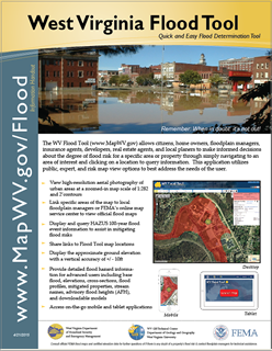
High-Risk Advisory Zones: : High-risk advisory zones – Preliminary NFHL, Advisory A, or Updated AE – are non-regulatory 1%-annual-chance flood zones represented as orange-colored flood zones in the WV Flood Tool. These advisory flood zones are generated from new model-backed flood studies or from redelineation mapping. Redelineation is the method of updating effective flood hazard boundaries to match updated topographic data based on the computed water surface elevations from effective models. The public should be informed that these non-regulatory zones will most likely become effective when new Flood Insurance Rate Maps (FIRM) are published, and thus any development in these zones should be regulated to the same standards as effective high-risk flood zones. In local floodplain ordinances, communities may choose to adopt high-risk advisory zones as "community-identified floodplains" and regulated the same as the Special Flood Hazard Area of the official Flood Insurance Rate Map (FIRM). Besides showing flood prone areas that are likely to be “mapped into the SFHA” in a future FEMA Flood Restudy, the high-risk advisory zones are also beneficial in identifying Letters of Map Amendment (LOMAs) for structures or property that should be “removed from the SFHA.”
Flood Height Grid: Gridded base flood heights are important for floodplain management and flood risk assessment activities. Presently, in the Flood Query Results Panel, model-backed flood height values are displayed for Approximate A Zones and AE Zones for 35 and 7 counties, respectively. FEMA now accepts the Advisory Flood Heights (or Advisory BFE) displayed on the WV Flood Tool for LOMA determinations and for Elevation Certificates. Gridded base flood elevations for AE Zones (Restudies/Non-Restudies) displayed in the Flood Query Results Panel of the WV Flood Tool should be confirmed with the Flood Profile in the Flood Insurance Study. Composite Water Surface Elevation Grids are organized and published separately by source methodology: Risk MAP Restudy, Non-Restudy (AE Zone Redelineation), and Advisory Flood Height (Approximate A Zone) studies.
Water Depth Grid: The base flood water depths are important for communicating flood risk. Water depths are published in the Flood Query Results Panel and used for computing the Water Depth-in-Structure for the building-level flood risk assessments. The Water Depth is the principal input for the 3D flood visualizations. The statewide Hazus depth grid created in 2010 is not very accurate, and thus a priority is to attain model-backed depth grids for full statewide coverage. Two statewide, composite Depth Grids are organized and published separately by the source software utilized: HEC-RAS engineering software and Hazus software.
LOMAs Verified: Letters of Map Amendment (LOMA) in which the positional accuracy of the x-y coordinates has been verified by legal descriptions, deed book/page number, parcel identifier, or E-911 address. Verified LOMAs are displayed in the EXPERT and RISK MAP Views of the WV Flood Tool. Current and historical LOMAs categorized as Structure Non-Removal, Removal, or Out as Shown.